
In 1978 the Seattle Department of Community Development published this map to raise awareness of the city's cultural landmarks.
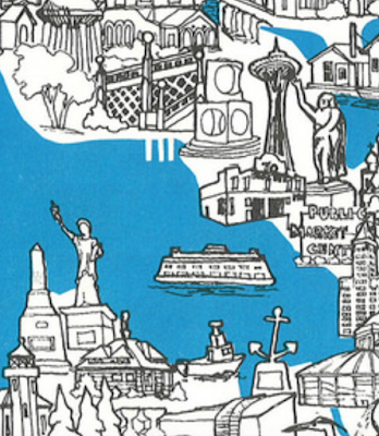
 Seattle Municipal Archives posted a scanned copy on their Flickr site. The cover is a nice grouping of buildings, statues and ferries.
 Inside the map is densely populated with landmarks and yellow descriptive text bubbles,
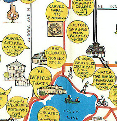
sometimes with additional info or commentary added.
 Some more detailed scans can be found on Rob Ketcherside's Flickr pages.
 One final view-because I briefly lived near the Arboretum Gate House


No comments:
Post a Comment